Spectacular trip to southern Utah this year. Here is a small sample of some of the drone aerial photographs I captured.
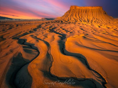
Factory Butte Utah – Drone view during the twilight hour at Factory Butte at the Southern Utah Badlands.
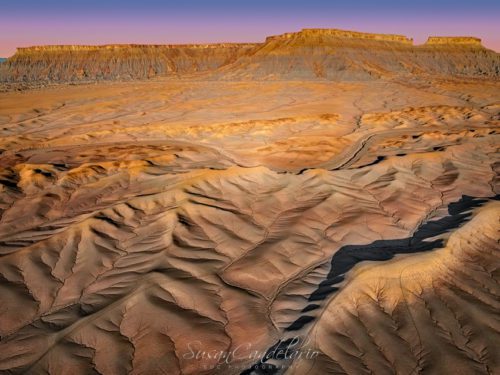
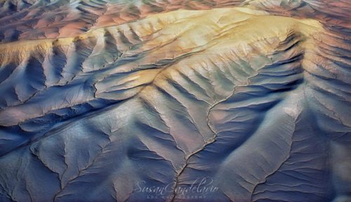
Aerial Utah Badlands – Drone view during the golden hour by the North Cainville Mesa in the Southern Utah Badlands. Seen are the many layers in the landscape and the many abstracts created from this upper view.
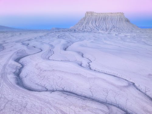
Factory Butte Utah – Drone view during the twilight hour at Factory Butte at the Southern Utah Badlands.
Utah Badlands Twilight – Drone View of the colorful patterns seen at the Bentonite Hills in the southern Utah Badlands during the blue hour of twilight. The Bentonite Hills appear as softly contoured, banded hills in varying hues of brown, red, purple, gray, and green. The hills are composed of the Brushy Basin shale member of the Morrison Formation. This layer was formed during Jurassic times when mud, silt, fine sand, and volcanic ash were deposited in swamps and lakes.
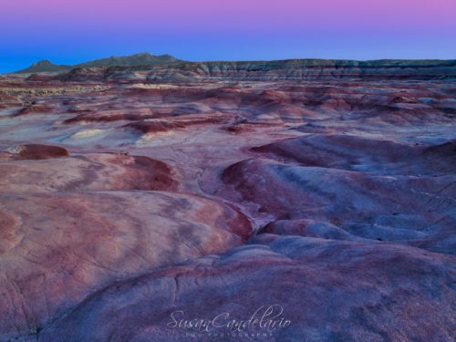
Abstract Trees In the Utah Badlands – Drone view during the twilight golden hour at the Southern Utah Badlands.
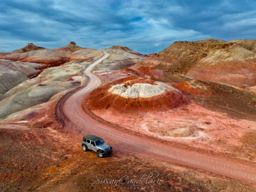
Utah Badlands Aerial – Drone View of the colorful Bentonite Hills with a Jeep Wrangler SUV. The Bentonite Hills appear as softly contoured, banded hills in varying hues of brown, red, purple, gray, and green. The hills are composed of the Brushy Basin shale member of the Morrison Formation. This layer was formed during Jurassic times when mud, silt, fine sand, and volcanic ash were deposited in swamps and lakes.